Northern Vietnam
Hanoi Captital
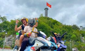
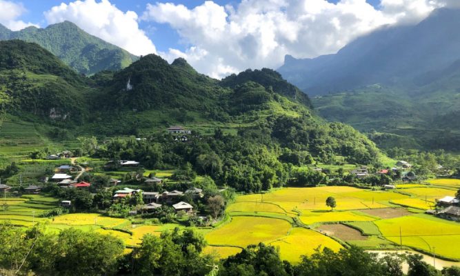
Mai Chau
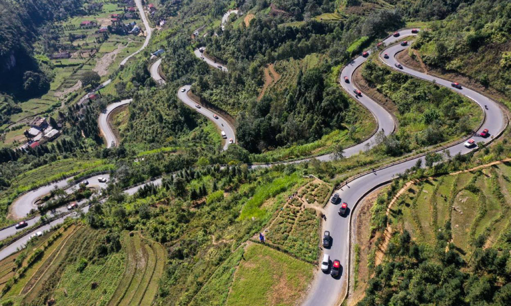
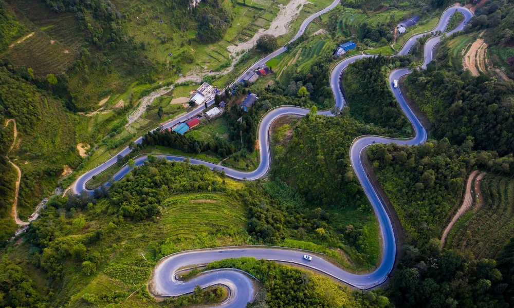
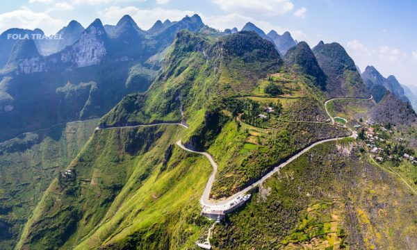
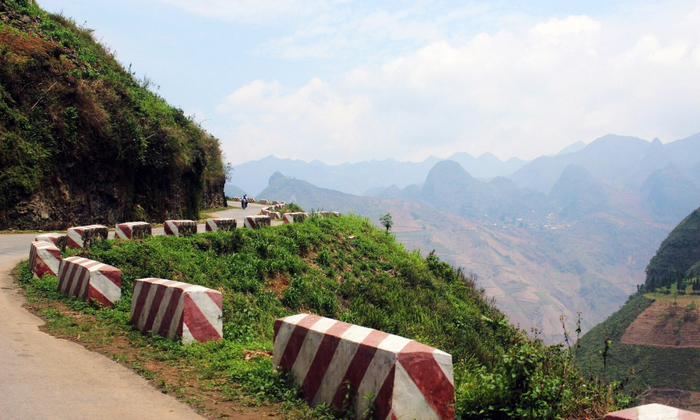
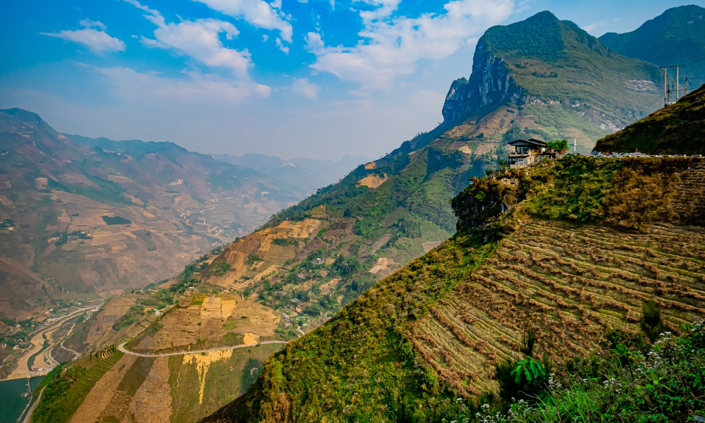
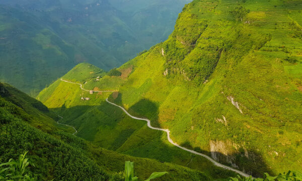
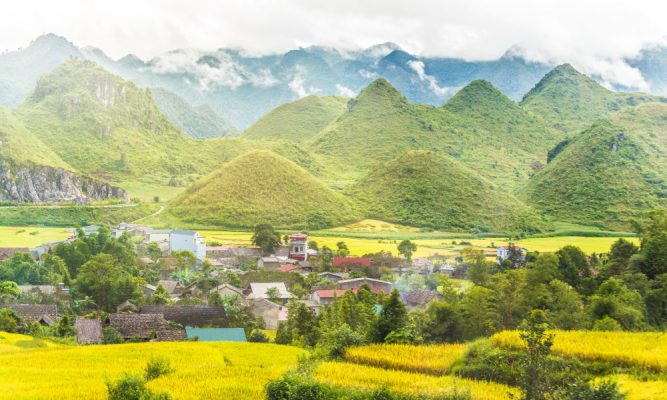
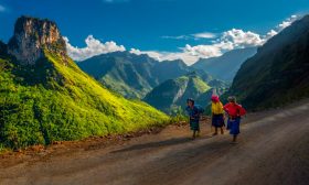
Ma Pi Leng Pass stands out as one of the most spectacular routes on the Ha Giang Loop. Gracefully winding around verdant mountain peaks, it offers views that are simply remarkable. Conquering Ma Pi Leng Pass is an exhilarating journey that promises to be an unforgettable highlight of your adventure.
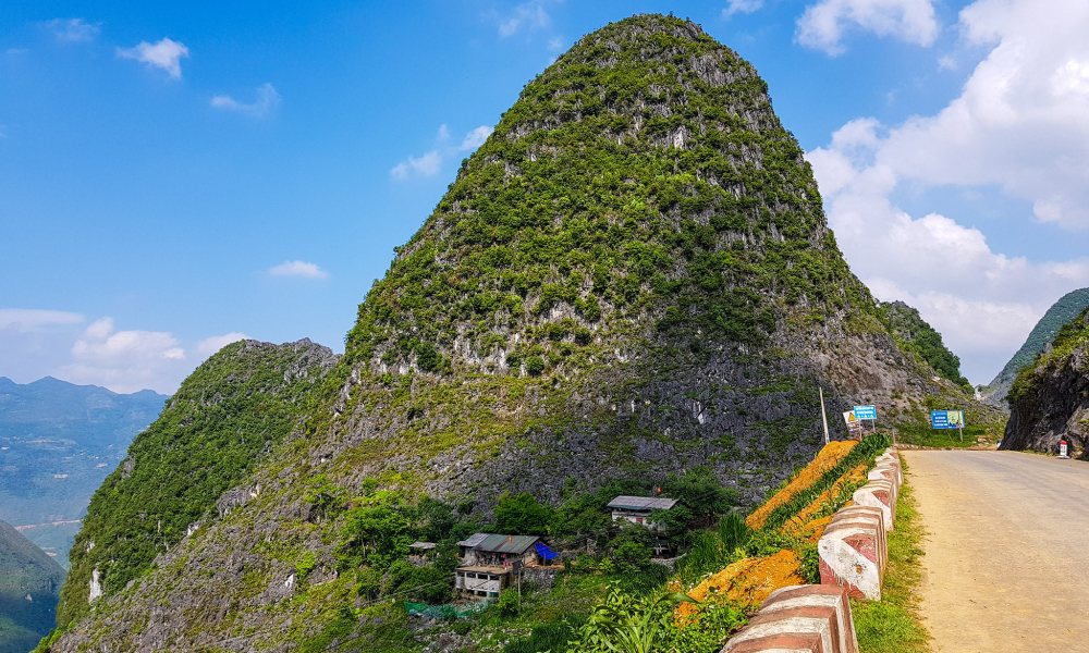
Ma Pi Leng Pass, an iconic section of National Highway 4C – famously known as the Happiness Road – carves its path through Pai Lung and Pa Vi Communes in Meo Vac District, and Ta Lung Commune in Dong Van District, Ha Giang Province. This dangerous yet breathtaking road spans approximately 20 kilometers, lying precariously at an altitude of 1,200 meters along the eastern slope of Ma Pi Leng Mountain.

Widely regarded as the most legendary pass on the Ha Giang Loop, Ma Pi Leng is ranked among the “four greatest mountain passes” of Vietnam’s northern region, along with O Quy Ho Pass (Ha Giang), Khau Pha Pass (Yen Bai), and Pha Din Pass (Dien Bien and Son La).
In 2009, the Ministry of Culture, Sports and Tourism of Vietnam officially designated the Ma Pi Leng area as a National Scenic Monument, including:
Ma Pi Leng Pass, meaning “horse nose” in ethnic Mong language, was opened on Ma Pi Leng Mountain in the 1960s, taking its name from the nearby village in Pai Lung Commune.
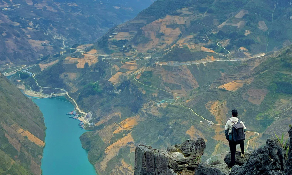
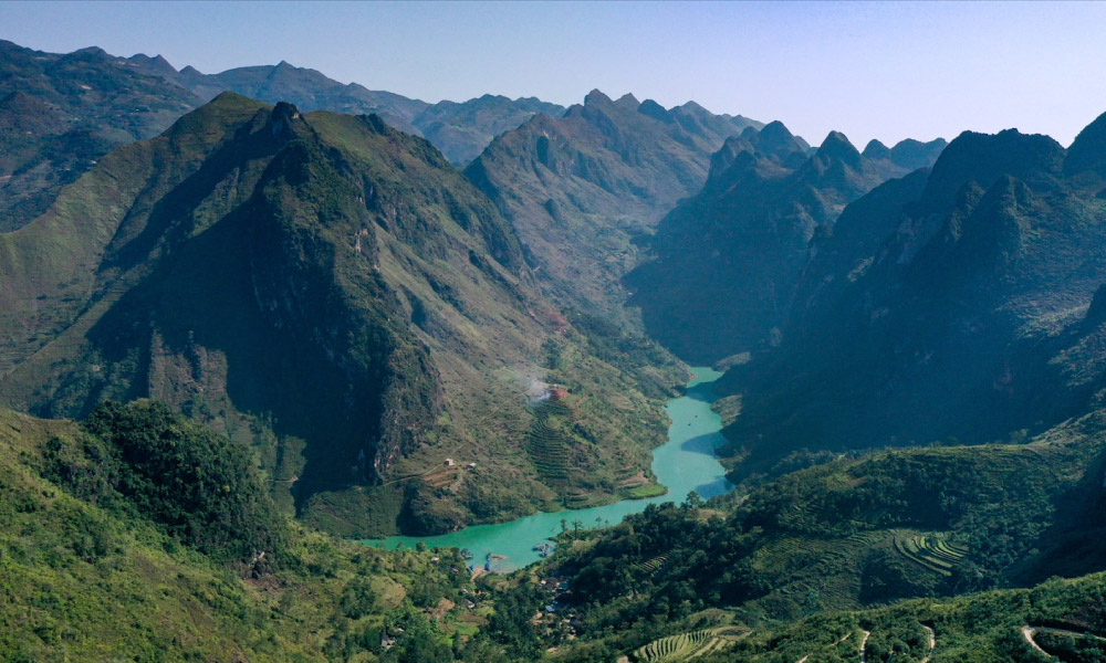
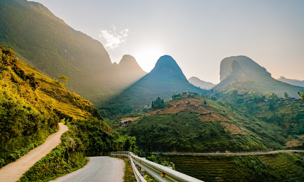
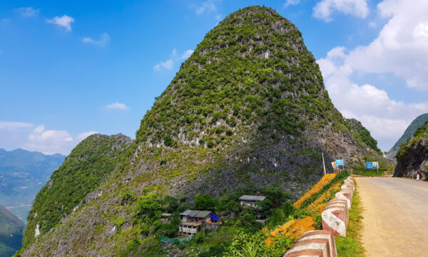
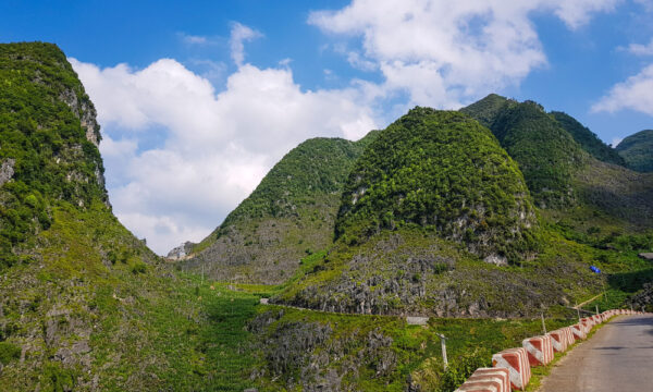
This rugged landscape is part of the Dong Van Karst Plateau Geopark, formed by numerous limestone and schist sediments, resulting in dramatic cliffs and deep abysses. Today, as you traverse the pass, you can admire the mesmerizing Nho Que River winding far below.
For Ha Giang generations before the 1960s, the only pathway they knew to cross Ma Pi Leng Mountain was by planting stakes and ropes on its cliffs to crawl through the nine brutally steep passes.
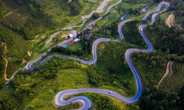
In 1959, driven by a vision to bridge the gap between this remote highland and the more developed areas, the Northern Vietnam Regional Party Committee decided to open the Ha Giang – Dong Van – Meo Vac road, now known as National Highway 4C. On September 10, 1959, this monumental undertaking began with over 2,300 volunteers and laborers from 16 ethnic groups across 8 Northern provinces. After 4 years, the 164-kilometer-long road was completed.
The most challenging section of the road, only 21 kilometers from Dong Van to Meo Vac, took 2 more years of hard work to complete. This perilous stretch is the legendary Ma Pi Leng Pass.
At the summit of Ma Pi Leng Mountain, the highest point of the Happiness Road, there is a rest stop where tourists can enjoy the incredible panorama of the Ha Giang landscape. In Pai Lung commune, the Youth Volunteer Memorial Stele serves as a permanent record of Ma Pi Leng’s construction.
Despite being incredibly challenging to conquer, Ma Pi Leng Pass’s wild, breathtaking beauty draws countless adventurous tourists from near and far.
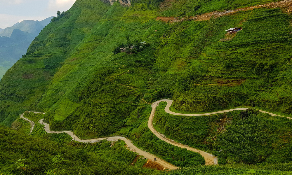
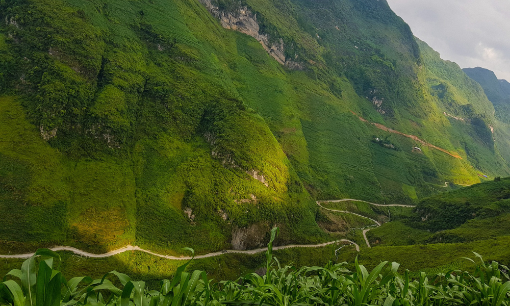
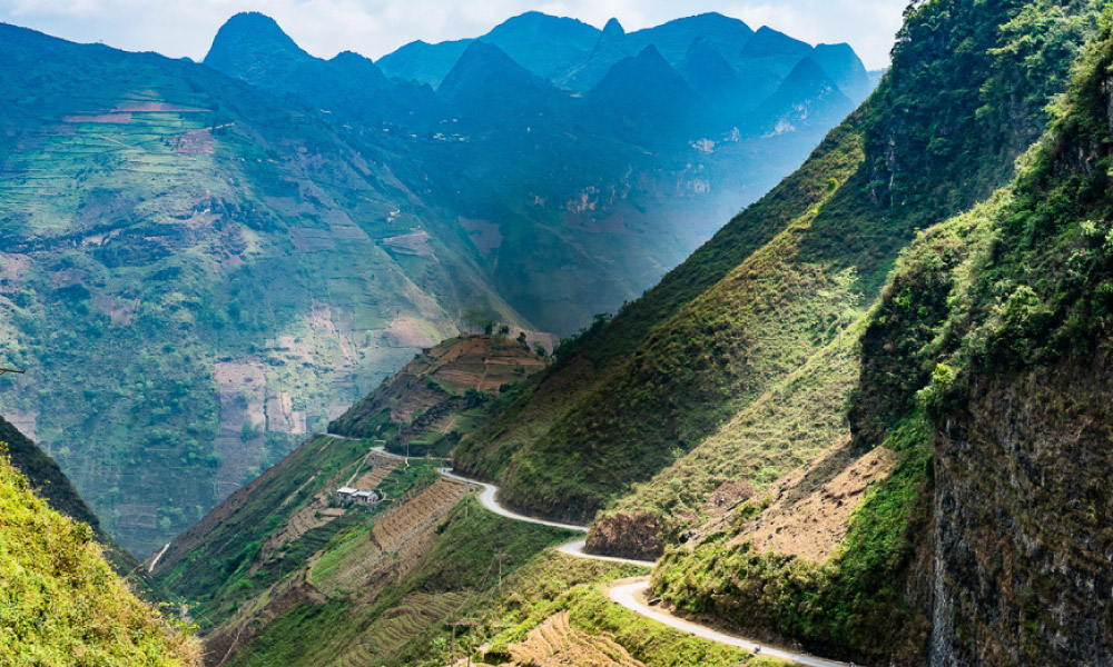
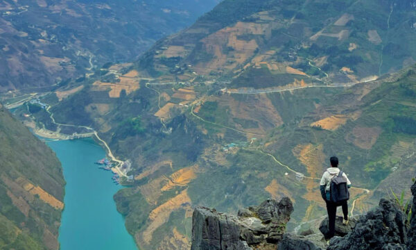
Located on a high mountain, Ma Pi Leng Pass consists of 9 winding bends, where one side falls into a deep abyss and the other rises in a steep slope. From its heights, the incredible panorama of Ha Giang unfolds: lush green mountain ranges extending to the horizon, winding Nho Que River gleaming like a jade ribbon, and hidden flower valleys revealing the quiet charm of ethnic villages.
As a section of National Highway 4C, finding the way to Ma Pi Leng Pass is simple enough. From Hanoi, visitors can travel by motorbike or car to Ha Giang City, and from there to Ma Pi Leng.
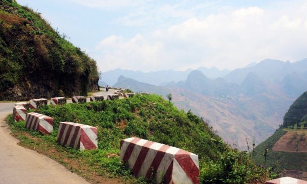
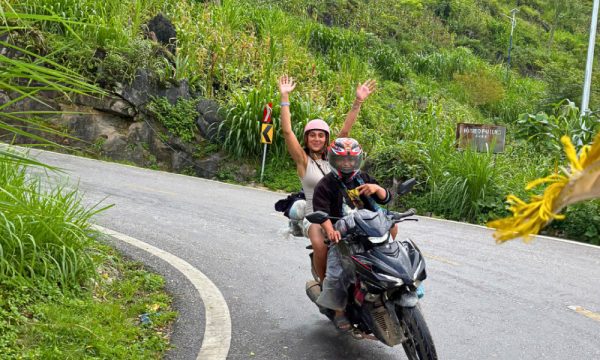
However, conquering this pass is not something everyone can do. Ma Pi Leng Pass is renowned for its narrow and steep stretches carved into the mountainside. The extended journey also demands good physical condition and resilience, or having multiple alternating drivers.
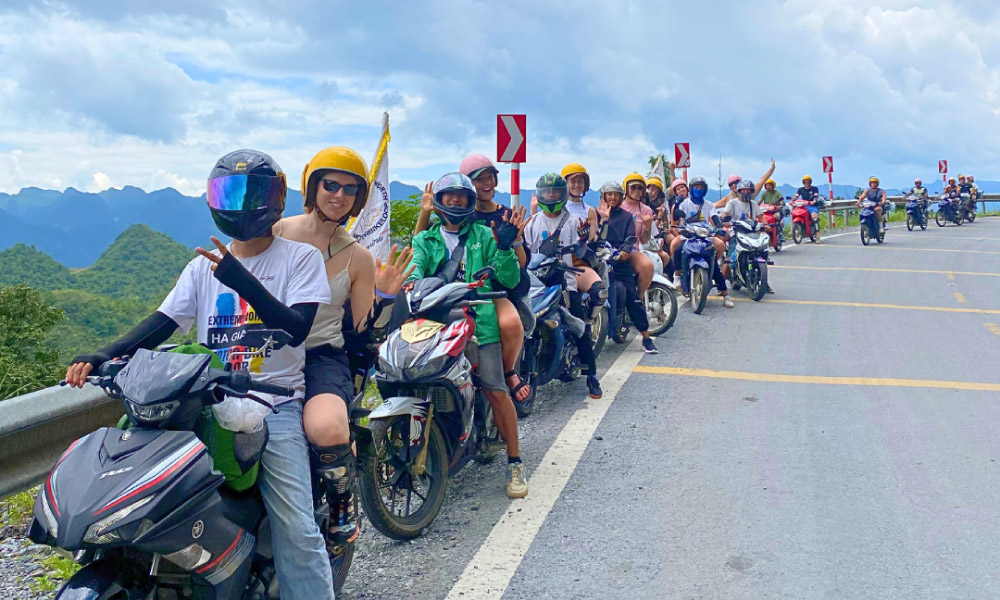
Fola Travel’s Ha Giang Loop tours eliminate these worries. In addition to food and accommodation, we provide transfer services from Hanoi to Ha Giang, and, crucially, professional easy-riders. This ensures a safe and comfortable exploration of the Ha Giang Loop, letting you focus solely on the incredible journey.
See more: Best Ha Giang Loop Tours for 2025.
Ma Pi Leng Pass serves as the ultimate vantage point, allowing visitors to immerse themselves in the captivating beauty that Ha Giang offers in every season.
While each period holds its unique charm, the prime time to visit the Ha Giang Loop is undoubtedly from October to April of the following year. During these months, the dry, cool weather is perfect for extended outdoor adventures. This is also the spectacular blooming season of Ban flowers (October, November), painting Ha Giang’s hillsides in a delicate white.

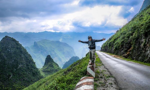
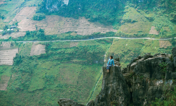
Imagine sitting on a protruding rock, with the majestic nature of Ha Giang as your backdrop, this freeing sensation is not something you can easily find anywhere else.

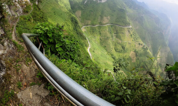
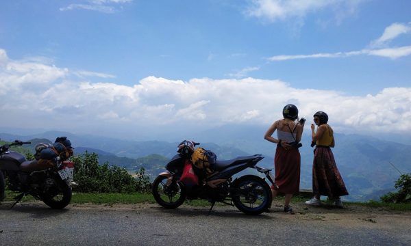
Along the Ma Pi Leng route, there are currently several rest stops, allowing visitors to take a break after a long journey and have time to admire the breathtaking natural vistas.
Among these stops, the most popular one is at Tu San Canyon, where the graceful Nho Que River tapers right at the foot of Ma Pi Leng Mountain. Looking down from here, the panoramic view will leave you speechless.
Right above Ma Pi Leng Pass, the White Cliff is the old mountain route used by Ha Giang locals before the National Highway 4C. Now, this is a camping spot sought by adventure lovers for a unique and thrilling experience.
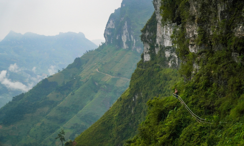
To get here, visitors must leave their motorbikes at the Youth Volunteer Memorial Stele, then walk along the small bridge up the cliff. This steep climb will make your heart skip a beat, and at the same time, grateful for the unreal natural beauty you get to witness.

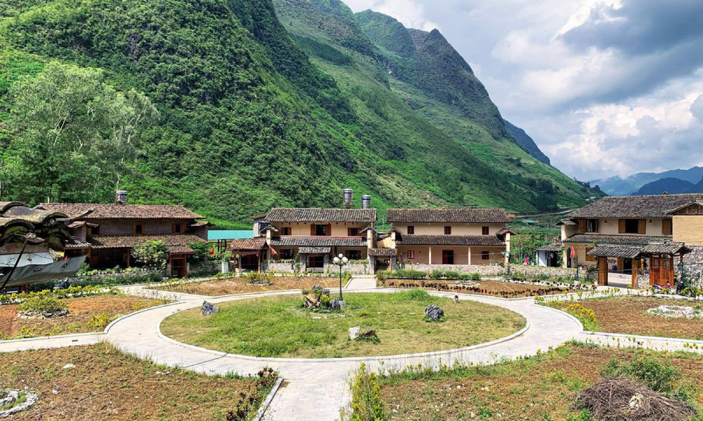
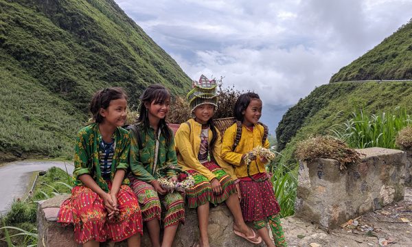
Nestled at the foot of the valley in Meo Vac, Pa Vi Village is a unique cultural complex. It serves as a great resting place on the Ha Giang Loop, offering travelers an opportunity to learn about the vibrant culture and traditional beauty of the local Mong people.


“TRAVELING IS OUR PASSION”
Let us help you plan an unforgettable trip!


SHARE YOUR OPINION